
Digital terrain models are used to analyze three-dimensional land surface, to design and visualize territories, to calculate volumes in open fields.
Digital Terrain Model (DTM) is a 3D representation of an area, information about which is obtained by scanning with LIDAR equipment or by aerial photography. Terrain model in the form of a point cloud shows the relief, vegetation, buildings and other objects in the area being surveyed.
Where and what is the DEM used for
Digital models serve as additional material for planners, designers and surveyors. Using DEM it is possible to calculate optimum parameters during buildings and constructions construction, develop designs of urban development projects, visualize project solutions.
Remote methods of acquiring information about the terrain (scanning and aerial photography) multiply simplified the procedure of land surveying. Today the productivity of area surveying by unmanned or manned aircraft is several thousand hectares per day. Three-dimensional modeling has reduced the time and cost of surveying work.
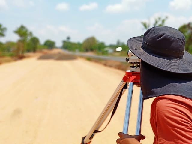
The main advantages of terrain modeling are evident in the surveying work. By processing the point cloud, the engineer receives information about the topography.
Areas of application of digital terrain models:
- Construction of relief for topographic plans;
- Determination of open-pit mining volumes;
- Executive BIM-models of LOD-2 level;
- Visualization of design solutions;
- Selection of the optimal path of the linear object;
- Territory monitoring, by comparing two DEMs made at different times;
- Determination of urban video camera installation points with the exclusion of “dead” zones.
To date, the main method of design related to the earth’s surface is based on digital models of terrain, relief and triangulation based on them. With the help of DEM it is possible to estimate in advance possible risk factors during construction and other works, avoiding negative consequences from possible influence of natural factors.
How to get data to build a DMM
To create a digital model of the landfill it is necessary to have a large amount of information about the location of characteristic points of all objects located on the territory. This is their coordinates, heights, color. Currently, information is collected from the air or from ground scanners – it is a practical, fast and accurate survey of the terrain using aircraft. The collected array counts millions and billions of points, the collected data is processed in a special software package. As a result, an accurate digital terrain model can be obtained within a few hours.
Types of DEM
Information about the site of future works, depending on the objectives can be presented in the following forms.
- Colorized dense point cloud
- Multilevel tile models.
- GRID grids.
Full-fledged activity of modern engineers, developers, designers in the development of plans for urban planning and development of territories is impossible without DEM – an exhaustive high-precision database of landscape conditions of the future works site of interest.
Digital modeling technology
Using aerial survey method
The initial data obtained in the process of aerial photography from a UAV are photos and data about their location at the moment of camera shutter release. The images are saved as RAW files. Then they are processed using special software in several stages.
- Spatial georeferencing of images so that software for photogrammetric processing could work with them. The result is a table with photo number and coordinates.
- Loading data into program, alignment (defining position and orientation of camera for each frame).
- Setting of reference points, which are used for accurate spatial binding of DEM. Specialists lay out and coordinate characteristic elements in the form of crosses or use existing markings on the ground as landmarks.
- Construction of dense point cloud, elevation map, orthophotomap and tile model.
Photogrammetric data processing results in DTMs with spatial resolution from 1 cm per pixel, depending on the accuracy required.
Laser scanning method
Scanning systems have an advantage over aerial photography techniques in point cloud density. They are used to create three-dimensional models of a built-up, forested survey area. Unlike airborne laser scanning (ALS), aerial photography will not be able to collect elevation marks in dense forest. The accuracy of the pulse reflection makes it possible to get within an error of 2-3 mm in height, which is much more accurate than AFS.
The use of aerial photography with UAV and VLS to build digital terrain models significantly expands the possibilities for space exploration and obtaining information about it. It allows to obtain in a short time a realistic model of high quality, which is comparable with laser scanning, but affordable.


