The accurate measurement of land and identification of property boundaries are essential components in real estate, construction, and land development. Registered surveyors occupy a crucial position at the core of these activities as they undertake the tasks that involve precisely mapping out territories while recording them with precision. This article delves extensively into registered surveyors’ world to highlight their significance, functions, duties as well examine how their contributions impact different industries.
Navigating the digital landscape requires a strategic approach, especially when it comes to building backlinks. Just as registered surveyors meticulously map out territories, companies must also chart their course through the vast realm of online visibility.
What is a Registered Surveyor?

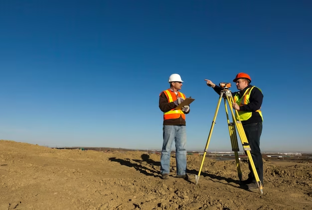
The primary duties of a registered surveyor are centered around the precise measurement and mapping of land surfaces, for which they hold both licensure and specialized qualifications as professionals. Their primary responsibilities include:
- Determining Property Boundaries: Registered surveyors possess expertise in precisely defining property boundaries, a crucial factor for resolving property disputes and establishing ownership while ensuring precise land use.
- Creating Land Maps: Producing land maps involves crafting precise and comprehensive depictions that faithfully depict the terrain, landscape highlights, and measurements associated with plots of ground. These cartographic representations serve indispensable functions spanning diverse areas such as real estate expansion or civil planning initiatives.
- Preparing Legal Documents: In the preparation of legal documents pertaining to land, registered surveyors are crucial. Their responsibilities include conducting land surveys, crafting property descriptions and boundary agreements. These essential papers serve a variety purposes in matters such as legal proceedings, real estate transactions or development endeavors.
The Role of Registered Surveyors
Registered surveyors are indispensable in several key industries due to their expertise and ability to provide accurate land data. Here are some specific roles they play:
Real Estate
Registered surveyors are essential in the real estate industry for the following reasons:
- Property Boundaries: They determine the precise boundaries of properties, ensuring that buyers and sellers have a clear understanding of the land they are dealing with.
- Property Valuation: Accurate land measurements and boundary information are crucial for determining the value of real estate properties.
Construction
In the construction sector, registered surveyors contribute by:
- Site Analysis: They provide accurate land measurements and topographic data, which are essential for architects and engineers to design and plan construction projects effectively.
- Site Layout: Registered surveyors help lay out the foundation and structures of buildings, ensuring they align with property boundaries and regulations.
Government
Government agencies rely on registered surveyors for:
- Land Development: Surveyors assist in the development and planning of land use, zoning regulations, and infrastructure projects.
- Property Tax Assessment: Accurate land surveys help determine property taxes, ensuring fair taxation for property owners.
Training and Qualifications
To become a registered surveyor, individuals must follow a structured path of education and training:
- Relevant Degree: Aspiring surveyors typically pursue a bachelor’s degree in surveying, geomatics, or a related field. This degree provides the foundational knowledge required for the profession.
- Professional Training: After completing their degree, individuals often need to gain practical experience through internships or apprenticeships under the guidance of experienced surveyors. This hands-on training helps them develop the skills needed for the profession.
- Licensure Examinations: The final step involves passing a series of licensure examinations. The specific requirements may vary by jurisdiction, but these exams typically test candidates on their knowledge of surveying principles, laws, and regulations.
The Work of Registered Surveyors
Registered surveyors perform a variety of tasks, each with its unique purpose and importance. These tasks include:
Boundary Surveys
A boundary survey is one of the fundamental responsibilities of registered surveyors. It involves determining the exact perimeters of a property, which is essential for legal and land-use purposes. Boundary surveys help property owners, developers, and government authorities to establish property lines and resolve disputes.
- Property Line Identification: Locating and marking the boundaries of a property, often using physical markers or monuments.
- Legal Documentation: Preparing accurate boundary descriptions and surveys for legal records and property deeds.
- Dispute Resolution: Resolving disputes over property boundaries by providing expert testimony and evidence.
Topographic Surveys
Topographic surveys involve mapping the contours and features of the land’s surface. These surveys are crucial for various purposes, including urban planning, engineering design, and environmental assessment.
- Elevation Data Collection: Measuring and recording elevation data to create contour lines, which depict land slopes.
- Feature Identification: Identifying natural and man-made features, such as buildings, trees, rivers, and roads.
- 3D Mapping: Creating accurate 3D models of the terrain, which aid in project planning and design.
Construction Surveys
Construction surveys play a vital role in the building process. Registered surveyors assist in the layout and preparation of construction sites, ensuring that structures are built according to the specified plans and dimensions.
- Site Preparation: Marking boundaries and reference points on the construction site to guide builders and contractors.
- As-Built Surveys: Verifying that constructed structures align with the approved design plans and specifications.
- Grading and Leveling: Ensuring proper site grading and elevation for foundations and infrastructure.
Land Division
Land division surveys are conducted to divide a larger tract of land into smaller plots, often for sale or development. This process is essential for urban planning and property management.
- Plot Layout: Determining the size and boundaries of individual plots within a larger land parcel.
- Legal Compliance: Ensuring that land division complies with zoning regulations, subdivision ordinances, etc.
- Record Keeping and Platting: Preparing plats and legal documents to officially document the divided land.
Tools and Technology
Modern registered surveyors leverage advanced tools and technology to enhance the accuracy and efficiency of their work. These tools have revolutionized the field of land surveying, allowing for more precise measurements and faster data processing. Some of the key tools and technologies used by registered surveyors include:
| Technology | Description |
| Global Positioning System (GPS) | GPS technology has become an indispensable tool for land surveyors. It allows for precise location determination through satellite signals, enabling accurate positioning of survey points and boundary markers. |
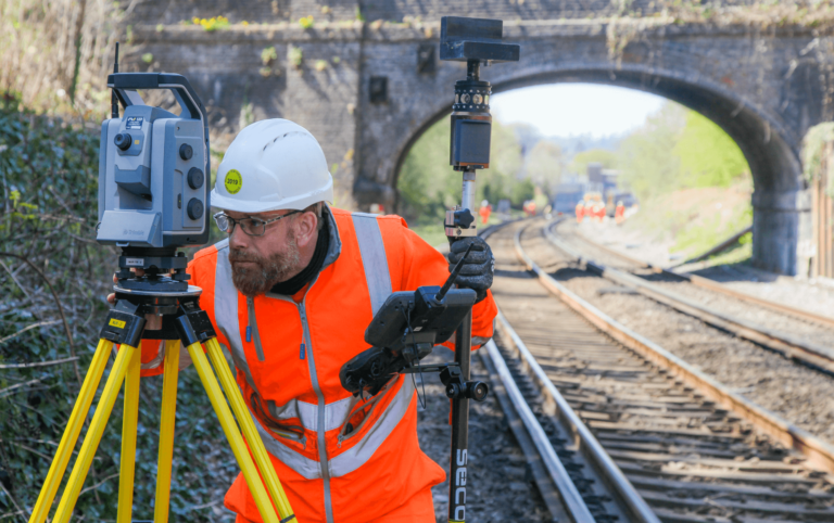
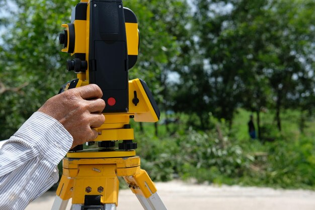
| Total Stations | Total stations combine electronic distance measurement (EDM) with theodolite functionality. Surveyors use total stations to measure angles and distances with high accuracy, making them essential for various survey tasks. |
| Drones (Unmanned Aerial Vehicles) | Drones equipped with high-resolution cameras and GPS technology have revolutionized topographic surveys. They can quickly capture aerial imagery and generate detailed 3D models of the terrain. |
| 3D Laser Scanners | 3D laser scanners are used for capturing precise point cloud data of objects and environments. They are especially valuable for as-built surveys and creating accurate 3D models. |
| Geographic Information Systems (GIS) | GIS software allows surveyors to analyze and manage spatial data efficiently. It is used for creating maps, performing geospatial analysis, and storing survey information. |
| Computer-Aided Design (CAD) Software | CAD software aids in the drafting and design of survey plans and maps. It enables surveyors to produce detailed and accurate drawings for legal documentation and construction projects. |
| Mobile Data Collection Apps | Surveyors use mobile apps to collect and store data in the field. These apps streamline data collection, reduce errors, and improve data accessibility. |
| Robotic Total Stations | Robotic total stations can be operated remotely, increasing efficiency by allowing a single surveyor to control the instrument and collect data. |
Impact of Registered Surveyors in Different Sectors

Registered surveyors play a significant role in various sectors, contributing to the accuracy, legality, and efficiency of projects and processes. Let’s delve into the impact of registered surveyors in different sectors:
Real Estate Sector
In the realm of real estate, registered surveyors wield a profound influence by providing clarity and legality to property boundaries. This is indispensable for property transactions and dispute resolutions.
- Property Boundary Clarity: Registered surveyors meticulously identify, mark, and document property boundaries. This clarity ensures that buyers and sellers have a precise understanding of the land they are dealing with, preventing future disputes.
- Transaction Facilitation: Their work simplifies property transactions, as prospective buyers can confidently assess the property’s dimensions and boundaries, allowing for smoother negotiations and contracts.
- Dispute Resolution: In the event of property boundary disputes, registered surveyors are often called upon to provide expert testimony and evidence, helping to resolve legal conflicts efficiently.
Construction Sector
In the construction sector, registered surveyors play a pivotal role in ensuring that construction projects adhere to planned designs and legal boundaries, thereby preventing costly errors.
- Layout and Alignment: Registered surveyors assist in the initial layout of construction sites, ensuring that buildings and infrastructure align accurately with the design specifications. This is essential to avoid structural issues and costly rework.
- Elevation Control: They oversee elevation control, ensuring that foundations and structures are at the correct height relative to established benchmarks. Proper elevation control is crucial for structural stability and floodplain compliance.
- Quality Assurance: Registered surveyors perform as-built surveys, verifying that the constructed structures match the approved plans. This quality control process safeguards against deviations from the design and specification standards.
Government and Planning Sector
Governments at various levels rely heavily on registered surveyors for urban planning, infrastructure development, and the maintenance of public land records.
- Urban Planning: Registered surveyors assist in urban planning initiatives, helping government agencies design and develop cities and communities with an emphasis on sustainable land use, transportation, and infrastructure.
- Infrastructure Development: They contribute to infrastructure projects by providing accurate land data and topographic surveys. This data aids in the design and construction of roads, utilities, and public facilities.
- Land Records Maintenance: Registered surveyors are instrumental in maintaining public land records, ensuring that property information is accurate and up-to-date. These records are crucial for taxation, zoning, and land use planning.
Legal and Ethical Responsibilities
Registered surveyors operate within a framework of legal and ethical standards to uphold the integrity and impartiality of their work. Key responsibilities include:
- Accuracy: Registered surveyors must provide precise measurements and boundary determinations. Inaccurate surveys can lead to legal disputes and financial losses.
- Confidentiality: They are obligated to respect the privacy and confidentiality of their clients, ensuring that sensitive information remains secure.
- Ethical Practices: Registered surveyors are expected to adhere to ethical practices, avoiding conflicts of interest and conducting their work impartially. This ensures fairness and transparency in their dealings.
Conclusion
Registered surveyors are indispensable in accurately mapping and documenting land. Their work ensures legal compliance, aids in construction and development, and plays a crucial role in real estate transactions. Understanding the role and importance of registered surveyors is vital for anyone involved in land-related activities.
FAQ
Q: How do I find a registered surveyor?
A: You can search for registered surveyors through professional bodies or online directories.
Q: What is the cost of hiring a registered surveyor?
A: Costs vary based on the survey type and the property’s size and location.
Q: How long does a survey take?
A: The time frame depends on the survey’s complexity and the property’s characteristics.
Q: Is it mandatory to hire a registered surveyor for property transactions?
A: While not always mandatory, it is highly recommended for legal certainty and accuracy.
Q: Can registered surveyors resolve property disputes?
A: Their expertise and impartial measurements can significantly aid in dispute resolution.






+ There are no comments
Add yours