
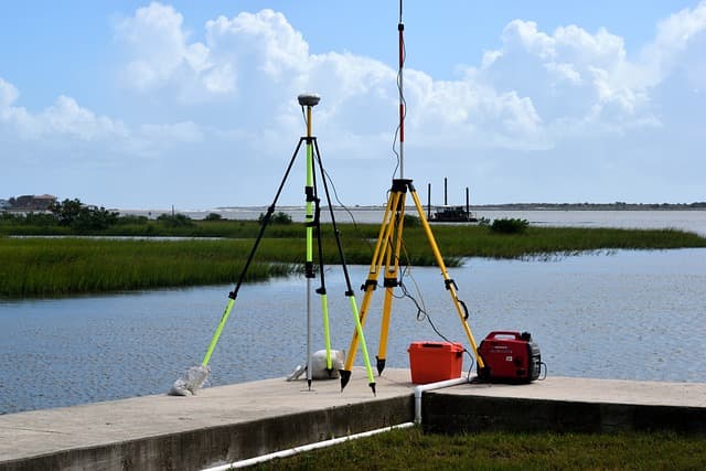
The topographic survey helps to identify the peculiarities of the site and mark the existing objects on it. The complex of engineering and geodesic works is carried out with the help of special equipment with the departure of masters to the site for construction. The results of topographic survey are used for creating project documentation and performing further work on the territory. Topographic maps are executed at different scales, which allows reflecting on them both small areas and vast territories.
Types of topographic surveying
Topographic maps are not only used in construction industry. Tourists, geologists, seafarers and drivers often need them. Engineering and topographic works are carried out before the main stages of construction and preparation for them begin. In everyday life and in construction different types of topographic maps are used, which causes the surveying to be carried out in different ways:
- Theodolite surveying. A special instrument – theodolite allows to obtain a contour map showing all buildings and objects. Further the map can be supplemented and edited by other methods.
- Taheometric survey. Is the most common way to obtain topographic plans. The survey is notable for low cost and map detail. Usually this type of survey is carried out at a scale of 1:500.
- Mandrel system. The system is mainly used in surveying of mine workings areas, industrial sites, open pits and embankments. It may replace aerial photography if necessary.
- Surface leveling. The method helps to get a detailed image of the territory. Squares and highways method is used for mapping.
- Photo-teodolite survey. Using images a topographic plan is created with high accuracy. The process can be automated if a graphic plotter is involved.
- Laser scanning. This technology can be used to obtain topographic plans even for complex structures. The scanning does not interfere with the construction works. Scanning is very fast, so the client gets a ready result in a short time. This method is the most accurate and is used when it’s necessary to obtain a high quality photograph.
- Aerial photography. This technology is used to obtain high quality imagery of large objects. Most often, photography is used to perform large-scale works.
- Combined imagery. Often there is a need to specify any details during mapping and a different method of topographic survey can be used for this purpose.
Features of topographic survey
Topographic surveying is carried out in several stages, which allows you to thoroughly study the area and its features. When ordering work in the company, it is necessary to draw up a contract, which will spell out all the nuances. Also, if there are earlier results of topographic survey, it is advisable for the customer to attach them during the signing of papers. There are four main stages:
- Preparatory. Specialists collect information about the site and previously conducted survey.
- Field. At this stage, all measurements and inspections of the territory are made. The works are carried out using special equipment.
- Camera. Employees perform computational operations and process previously collected information. If necessary, the location of communications can be clarified.
- Final. This is the last stage, which involves the formation of a report on the work performed and the preparation of a package of documents.
Purpose of topographic mapping
Since topographic maps are used in almost all spheres, they perform many functions. Despite their high prevalence, the main purpose of plans is to display the terrain in graphic form. Depending on the scale of the topographic map, its purpose also changes:
- Scales of 1:50, 1:100, 1:200 are quite rare and are used primarily in the creation of landscape design or design of small buildings.
- In geodetic works, mainly 1:500 scale is used. Maps include the necessary data about the site.
- The 1:1000 and 1:2000 scales are necessary for laying highways and pipelines. Topographic survey for gasification is carried out at this scale.
- Plans in scale 1:5000, 1:10000 are used during development of city plans, large factories, enterprises and trade centers.
All types of topographic survey should display buildings, steel structures, relief features on the site in order to get a real picture and subsequent planning of territory use.


