
The necessity of surveying areas covered by thick vegetation is one of the obstacles faced while employing traditional land surveying methods. Some surveying projects necessitate the measurement of such vegetation, however, the majority of applications necessitate the measurement of the terrain itself, not the vegetation that covers it. Depending on their intended purpose, topographic surveyors may or may not need vegetation measurement.
The Interplay of Vegetation in Survey Accuracy
Traditional surveying equipment may be hindered by huge trees or other barriers while land surveyors are on the ground. Because of high slopes, inconvenient streams, or any other man-made or natural characteristics, they may be unable to traverse the area. These characteristics, when combined, may make surveying on the ground difficult, if not impossible, especially in undeveloped areas. There are, however, ways to get over these roadblocks, allowing surveyors to generate accurate surveys.
Some surveying techniques can ground cover and penetrate trees. LiDAR, a laser-based technology, is one of them. Because the laser equipment is carried in an airplane and flown over the area, it is perfect for highly forested locations where walking is difficult or impossible.
Technological Advancements Addressing Vegetation Challenges
Other surveying applications necessitate vegetation measurement. Similar aerial approaches do not penetrate trees, allowing the topographical surveyor to operate from a distance while still getting a sense of the vegetation.
The vegetation found in a specific area is of special significance to one sort of surveying, known as “vegetation surveying.” Vegetation surveying, unlike regular land surveying, frequently illustrates rough borders rather than exact lines. Environmentalists, botanists and other earth science applications benefit from vegetation surveys, or the mapping of plant ecosystems. A vegetation survey may reveal areas with and without vegetation, as well as plant type, density, and location, depending on its intended application. These maps can be used to detect vulnerable biological areas, chart plant spread, or investigate environmental changes after natural or man-made disasters.
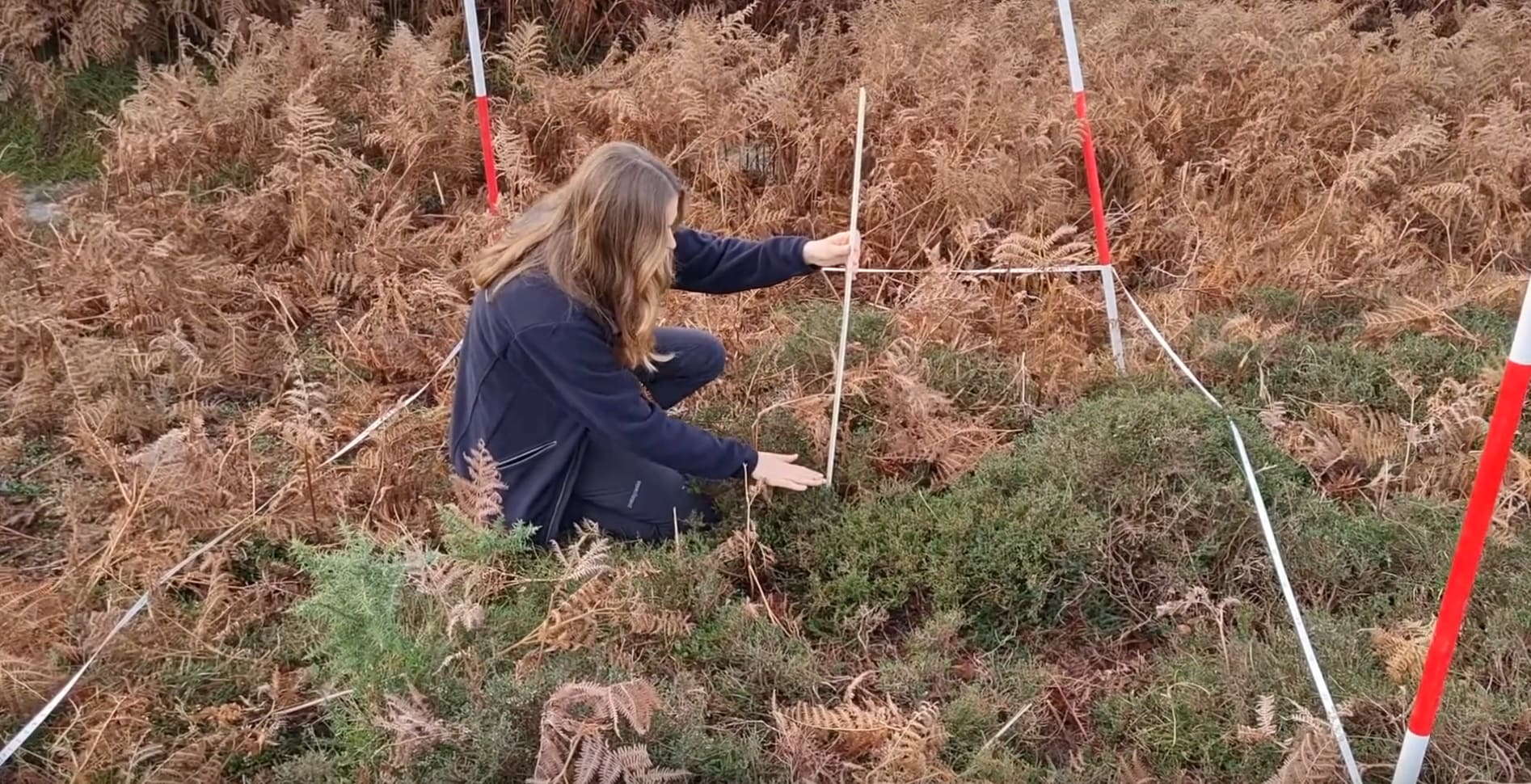
When vegetation surveying is required, measurements can be obtained from the air or using a surveyor’s transit to measure vegetation height and set out a grid of the landscape onto which vegetation can be measured. After a period of time, another surveying team can utilize the same grid to measure modifications in terrain and vegetation.
Strategies for Effective Vegetation Management in Surveying
While topographical maps may show vegetation or man-made structures, a digital terrain model usually only shows the topology and terrain beneath the vegetation. Digital terrain models are also known as bare-earth models, whereas digital surface models include plants and other above-ground characteristics.
Direct surveying or remote sensing technologies, LiDAR approaches, and photogrammetry are some of the surveying methods used to construct topographic surveys or digital terrain models. The best strategy relies on the size of the area to be surveyed as well as the amount and type of data needed. Some of the surveying methods used to construct these models, such as radar, reflect the highest elevation point on a particular place, whether that is the top of a tree, building, or bare land, while others are intended for terrain assessment. See us today at Redhawk Surveying in OKC for topographical survey, ALTA survey and more.


+ There are no comments
Add yours