Engineering surveyors, also referred to as surveyor engineers, perform a crucial function in the complex domain of land development and construction. Their specialized knowledge serves as a link between abstract designs and tangible structures – a vital component for numerous projects. This article offers an extensive examination into the world of these professionals, uncovering their duties, aptitudes, and noteworthy influence on shaping our surroundings.
The Role of a Surveyor Engineer in Modern Development

The surveyor engineers, who perform critical roles in construction, urban planning and environmental management fields are often overlooked. Their primary responsibilities include:
Land Assessment
A crucial duty of surveyor engineers is to perform comprehensive land evaluations, which involve scrutinizing the topography, limits, and ecological characteristics of a specific parcel. This vital first phase holds significant importance for various reasons:
- Feasibility Assessment: Surveyor engineers evaluate the viability of construction projects through an analysis of the land and detection of possible hindrances or constraints. This data holds great significance for project design and financing purposes.
- Environmental Impact Assessment: In order to comply with environmental regulations and minimize ecological disruptions, surveyor engineers must possess a comprehensive understanding of the natural attributes of an area. This enables them to conduct an Environmental Impact Assessment to determine the potential environmental impact that may result from development activities.
- Land Use Planning: Urban planners depend on evaluations made by surveyor engineers to make well-informed choices concerning land utilization and zoning in the field of land use planning. Therefore, it guarantees that constructions are consistent with both city plans’ objectives and regulations.
Data Analysis
To support planning and design processes, surveyor engineers possess a proficient ability to analyze geographic data sourced from various outlets. The key components involved in such analysis are as follows:
| Category | Description |
| Aerial Photographs | By utilizing aerial photographs, surveyor engineers are able to obtain a thorough understanding of the land and its environment. Such images offer valuable information about various aspects of the terrain as well as potential obstacles that may be encountered during their work. |
| Satellite Images | By providing a comprehensive outlook, satellite imagery enables surveyor engineers to keep tabs on land transformations throughout time. It assists in monitoring advancements, recognizing land utilization trends and evaluating natural occurrences such as plant growth or soil degradation. |
| GIS Data | Surveyor engineers employ Geographic Information Systems as robust instruments for the analysis and management of data. These systems amalgamate a multitude of geospatial resources like maps, satellite photographs, and terrain models to generate comprehensive datasets that expedite informed decision-making processes and efficient project planning strategies. |
Precision Measurements
The foundation of any construction or development project is precise measurements. Surveyor engineers bear the responsibility to take meticulous measures of the land, verifying their accuracy and consistency in all instances. Such entails:
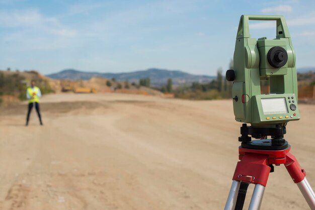
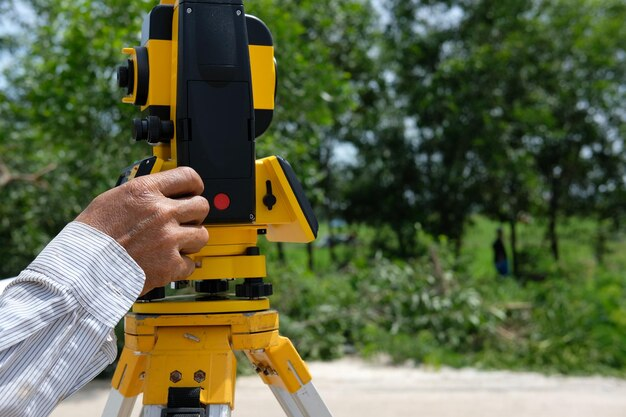
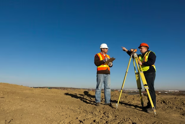
- Utilization of Advanced Instruments: The implementation of cutting-edge tools in surveying has a significant impact as it allows for precise measurements of distances, angles, and elevations. Some examples of such instruments include Total Stations and Global Positioning Systems (GPS), which are widely used by Surveyor engineers.
- Establishing Control Points: In order to make accurate measurements, surveyor engineers establish control points that serve as the basis for reference. These benchmarks have predefined coordinates and are carefully maintained throughout all stages of a project.
- Topographic Surveys: Detailed information about the surface features of land such as elevation contours, slopes and drainage patterns can be obtained from topographic surveys. This data plays an invaluable role in aiding architects and engineers during the design phase.
Legal Documentation
Surveyor engineers have a vital responsibility of not only collecting and analyzing data but also preparing and maintaining significant legal documents. These crucial documents play an essential role in resolving legal disputes as well as property transactions.
- Plats and Maps: Surveyor engineers are responsible for producing and revising plats and maps that precisely represent land borders, parcel divisions, and easements. These records are crucial in the maintenance of ownership deeds as they must be presented to government establishments.
- Boundary Surveys: Boundary surveys are conducted by surveyor engineers to accurately determine parcel boundaries when disputes arise. This valuable information aids in conflict resolution and the protection of property rights.
- Easement Documentation: The identification and documentation of easements, which are legal permissions to use another party’s land for defined activities like utility access, is undertaken by surveyor engineers. Precise recording of these easements holds great significance for both property owners and utility companies.
The Tools of the Trade

Engineering surveyors use a variety of sophisticated tools to perform their duties:
| Tool | Description |
| Total Stations | Electronic and optical instruments that are pivotal in surveying and building construction are referred to as Total Stations. Their primary purpose is to measure angles and distances with precision, merging the electronic distance measurement technique with a theodolite system. This convergence allows for precise recording of measurements along with detailed topographical data, offering high levels of accuracy sought after by most surveyors. |
| GPS Systems | By utilizing Global Positioning System technology, GPS Systems are transforming the way we acquire location data. These systems offer precise and immediate real-time information that is crucial for extensive outdoor survey projects. With their exceptional capabilities, they have proven to be more efficient and practical in large construction sites compared to traditional methods. |
| Laser Scanners | The use of Laser Scanners is essential in the creation of detailed 3D models and finds extensive application in analyzing structures and landscapes. These instruments emit laser beams to calculate distances, capturing measurements that pave the way for developing three-dimensional representations of surveyed objects or regions. Importance-wise, these scanners prove to be indispensable when it comes down to meticulous planning, designing procedures as well as maintenance needs concerning structures. |
| Drones (UAVs) | Unmanned Aerial Vehicles, commonly known as drones, have become a vital component in engineering surveying. These aerial devices are utilized for conducting surveys and creating maps of construction sites, providing an all-encompassing bird’s-eye view. Drones prove particularly advantageous when accessing hard-to-reach areas or gathering extensive visual and data material from massive locations. |
The Importance of Surveyor Engineers in Construction
In the realm of construction, the role of a survey engineer is multifaceted:
- Foundation Layout: The accurate layout of foundations is a crucial aspect of construction, and it falls under the primary duties of surveyor engineers. They are responsible for precisely setting out dimensions in accordance with design plans to maintain stability and integrity throughout the building or structure.
- Alignment and Leveling: Surveyor engineers are crucial for achieving perfect alignment and leveling throughout a construction project. Such precision is essential to ensure the building’s structural integrity and functionality. Any misalignments, no matter how small, can lead to significant hazards in the long run.
- Monitoring Structural Integrity: Surveyor engineers maintain a constant watch over the project’s structural integrity throughout construction. Their duties include verifying that the build adheres to designated design plans and detecting any divergences or possible complications in their initial stages. The essential role played by these experts lies in proactively identifying structural faults which could jeopardize safety and longevity of the completed structure.
Educational Pathway to Becoming a Survey Engineer
Becoming a surveyor engineer typically requires:
Bachelor’s Degree
Acquiring a bachelor’s degree in a relevant field is the first and crucial step towards becoming a competent survey engineer. In-depth knowledge of the fundamental principles and techniques employed in surveying requires strong educational groundwork. Here are some important factors to keep in mind:
| Requirement | Details |
| Degree Options | Enroll in a bachelor’s degree program that focuses on surveying, civil engineering, geomatics or any other related area. |
| Curriculum | Subjects usually included in the coursework are geodesy, land development, remote sensing techniques, cartography expertise and GIS (Geographic Information Systems) fundamentals along with legal principles pertaining to surveying. |
| Accreditation | For quality assurance, make sure to select a program accredited by the Accreditation Board for Engineering and Technology (ABET) or an analogous accreditation organization in your area. |
| Internships | During your undergraduate studies, consider seeking out internships or co-op opportunities to acquire hands-on experience. |
| Relevant Skills | Acquiring proficiency in mathematics, computer programming, data analysis and problem-solving is imperative for a survey engineer. |
Licensing
After earning your bachelor’s degree, the subsequent phase entails acquiring pertinent licenses and certifications. The licensing prerequisites vary depending on the region or country; however, a typical checklist of steps is as follows:
| Licensing Steps | Details |
| Work Experience | Supervised work experience under the guidance of a licensed surveyor is typically necessary for obtaining licensure from most authorities; duration varies between jurisdictions, with timeframes ranging from 2 to 4 years. |
| Exam | Get ready for and successfully clear a licensing examination that evaluates your comprehension of surveying principles, laws, and morality norms. The exam might encompass themes such as demarcation analysis, topographic mapping, and state-specific statutes. |
| Continuing Education | To keep your license valid, it’s essential to engage in regular professional development and continuing education. This guarantees that you stay informed of current industry developments and regulations. |
Continuous Learning
Continuous learning and staying updated with the latest technological advancements and legislative changes are crucial for those looking to excel in survey engineering. This field is constantly evolving, making it imperative to keep up-to-date on industry developments. Here are some ways to do so:
- Professional Associations: One way to gain access to valuable resources, conferences, and networking possibilities is by becoming a member of professional associations such as the National Society of Professional Surveyors (NSPS) or the American Congress on Surveying and Mapping (ACSM).
- Advanced Education: If you’re interested in advanced education, then studying for a master’s degree or earning additional certifications is worth considering. These can be focused on specialized areas of surveying like geospatial technology, hydrographic surveying and photogrammetry.
- Technology Integration: Adopt new and advancing technologies such as LiDAR, GPS, and drones to revolutionize surveying. Keep up-to-date with the most modern software and hardware resources available.
- Regulatory Updates: Stay up to date with regulatory updates regarding land surveying laws and regulations, particularly if you operate in various jurisdictions.
Difference Between Surveyor Engineer and Civil Engineer
Although surveyor engineers and civil engineers collaborate frequently, their responsibilities are separate:
- Focus: Surveyor engineers concentrate on measuring and analyzing land and structures, while civil engineers primarily handle designing and constructing these constructions.
- Skills: Surveyor engineers demonstrate excellence in precise measurements and data analysis, whereas civil engineers exhibit a greater inclination towards problem-solving and design.
Conclusion
Surveyor engineers, alternatively known as engineering surveyors, play an essential role in shaping our physical world. They oversee every step of the construction process from assessing a plot of land to finalizing structures while ensuring compliance with legal and design standards and prioritizing accuracy and safety. Their work supports responsible urban development as well as environmental conservation rather than solely benefitting the construction industry. Due to advancements in technology, opportunities for those interested in careers involving technical skills combined with outdoor work are on the rise within this field offering exciting prospects for individuals seeking such pursuits.
FAQ
What distinguishes a surveyor engineer from a land surveyor?
An engineer specializing in surveying places greater emphasis on the engineering components, including structural particulars and design elements; whereas, a land surveyor’s primary responsibility is establishing terrain boundaries and topography.
To what extent do surveyor engineers play a key role in urban planning?
Extremely significant. They furnish the required information to urban planners so that they can take educated decisions about land utilization, infrastructure growth, and environmental influence.
Is it possible for surveyor engineers to be employed on environmental projects?
Definitely. Surveyor engineers are crucial in environmental projects as they evaluate the effects of construction on the environment and participate in designing sustainable development strategies.


