
RTK surveying is a precise method of satellite navigation that improves the accuracy of position data derived from GPS and other satellite-based positioning systems. This technique exploits the phase of signal’s carrier wave rather than its information content, relying on a single reference station to provide real-time corrections for achieving high levels of precision in coordinate measurement.
The Fundamentals of RTK Survey
Real-Time Kinematic (RTK) technology for surveying is widely utilized in multiple industries due to its exceptional precision. The method delivers exact location data with accuracy that can typically reach a few centimeters, thanks to the implementation of specific components and methodology.
Components of an RTK Survey System
The primary components of an RTK survey system are essential for ensuring accurate and real-time positioning:
- GPS Receiver: The GPS receiver lies at the heart of the setup, gathering signals from Earth’s orbiting satellites. Contemporary receivers can handle transmissions from numerous satellite constellations including GLONASS (the Russian system), Galileo (European arrangement), BeiDou (Chinese design) and GPS – Global Positioning System.
- Portable Radio or Cellular Modem: A portable radio or cellular modem is utilized to facilitate instantaneous communication between the mobile unit (rover) and base station, transmitting critical data that enables swift application of precise corrections.
- GPS Antenna: The GPS antenna bears the responsibility of capturing signals from satellites and guaranteeing that they are precisely interpreted by the receiver. The design and location of this crucial component play a vital role in achieving optimal levels of accuracy.
Methodology of RTK Survey
The technology of RTK survey functions by comparing signals obtained from a stationary base station situated at an established position with those acquired by a mobile unit (rover). The following is how this procedure operates:
- Base Station Setup: The process of setting up a base station involves establishing it at a predetermined location with accurately identified coordinates and receiving signals from various satellites. The base station continually calculates its precise position using the received data, resulting in highly accurate readings.
- Rover Operation: The operation of the rover involves equipping it with an antenna and a GPS receiver, which enable it to receive signals from satellites that are also accessed by the base station on a continuous basis.
- Data Comparison: The rover matches the signals obtained from satellites with those received by the base station. Deviations present in these two sets of signals can signify inaccuracies in the rover’s location.
- Real-Time Corrections: Real-time differentials are calculated using these variances and transmitted from the base station to the rover through a portable radio or cellular modem for correction purposes.
- Accurate Positioning: Implementing these adjustments results in a notably precise localization of the rover, generally within mere centimeters of its true coordinates.
Benefits of Using RTK Survey
In various fields, the use of RTK survey technology provides a valuable tool delivering numerous benefits.
- Precision: The precision of RTK surveying is widely recognized for its outstanding accuracy, delivering location information up to a few centimeters with great reliability. This level of exactitude plays an indispensable role in fields such as construction, land measurement, and agriculture where precise positioning holds utmost importance.
- Efficiency: Compared to conventional survey methods, RTK surveying offers significantly improved efficiency by enabling real-time data collection and eliminating the need for extensive post-processing. Such time-saving benefits translate into cost savings for projects.
- Versatility: The adaptability of RTK survey technology allows it to be utilized in a diverse array of applications. It is often employed for precision farming within the agricultural sector, construction layout and monitoring in civil engineering, property boundary determination during land surveying activities, as well as geospatial studies within scientific research domains. Its versatility renders this tool valuable throughout numerous industries.
How RTK Survey Works
RTK (Real-Time Kinematic) survey technology relies on a sophisticated technique known as carrier phase enhancement, utilizing the phase of the signal’s carrier wave to enhance accuracy significantly. This process involves two crucial steps:
Signal Correction
In the first step of the RTK survey, signal correction is applied to mitigate various sources of GPS signal errors. These errors can be caused by atmospheric interference, variations in satellite orbits, and other factors. Signal correction is essential for achieving the high level of accuracy associated with RTK surveying. To break down the process further, consider the following key points:
- Base Station: A stationary base station, with known and precisely surveyed coordinates, continuously receives signals from multiple satellites overhead. These signals are subject to the same sources of error as those received by the rover.
- Error Sources: The signals transmitted by satellites can be affected by factors such as atmospheric conditions, satellite clock errors, and inaccuracies in satellite orbits. These errors introduce discrepancies in the received signals.
- Correction Computation: The base station calculates these discrepancies by comparing the observed signals with the known positions of the satellites. The computed corrections account for the errors and are then broadcast to the rover.
Position Calculation
In the second step, the rover uses the corrections received from the base station to calculate its precise position relative to the base station. This calculation is achieved by processing the carrier phase of the satellite signals. To delve further into the position calculation process:
- Rover Operation: The rover, equipped with its own GPS receiver and antenna, continuously receives satellite signals. These signals are affected by the same errors as the signals received by the base station.
- Differential Processing: By comparing the carrier phase of the signals received with the corrections provided by the base station, the rover can accurately determine the errors affecting its own measurements.
- High-Precision Positioning: Armed with the corrections, the rover computes its position with remarkable precision, often within a few centimeters. This high level of accuracy is ideal for applications that demand precise positioning, such as land surveying, construction, and agriculture.
The Role of Satellites in the RTK Survey
Satellites are fundamental to the functionality of RTK survey technology. They play a pivotal role in transmitting signals that are received and processed by both the base station and the rover. The characteristics and availability of satellites greatly influence the accuracy and reliability of RTK survey results. To understand the satellite’s role in the RTK survey comprehensively, consider the following points:
- Signal Transmission: Satellites in Earth’s orbit continually transmit signals that include precise timing information and their own positions.
- Satellite Constellations: RTK survey systems often rely on multiple satellite constellations, such as GPS, GLONASS, Galileo, and BeiDou. Access to signals from multiple constellations enhances the number of available satellites and improves the accuracy of positioning.
- Signal Reception: Both the base station and the rover receive signals from these satellites. The quality of the signals, their geometry, and the number of satellites in view are crucial factors in achieving accurate RTK survey results.
- Signal Redundancy: Having multiple satellites in view allows for redundancy in case some signals are obstructed or degraded due to obstacles or atmospheric conditions. This redundancy helps maintain a strong signal reception and robust RTK survey performance.
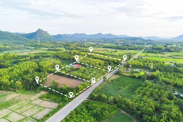
Applications of RTK Survey
RTK relies on precise GPS technology to provide real-time, centimeter-level positioning data. Below, we’ll explore key applications of the RTK survey, along with detailed information on setting up an RTK survey system and considerations for its successful implementation.
Construction
RTK survey plays a crucial role in construction projects, aiding in the precision alignment and placement of structures. Here’s how it benefits the construction industry:
- Foundation Alignment: The RTK survey ensures that building foundations are precisely aligned, reducing the risk of structural issues.
- Verticality Control: It helps in maintaining vertical alignment for structures like bridges and skyscrapers.
- Earthwork Monitoring: RTK survey enables accurate measurement of excavation and fill quantities, ensuring efficient use of resources.
Agriculture
In agriculture, the RTK survey is indispensable for precision farming techniques, improving crop yield and resource utilization:
- Precision Planting: Farmers can precisely plant seeds at optimal intervals, leading to better crop growth.
- Harvesting Efficiency: RTK-guided equipment ensures efficient harvesting by following precise paths.
- Irrigation Management: Accurate mapping of fields assists in efficient irrigation, conserving water resources.
Environmental Monitoring
RTK survey is used in environmental monitoring to track changes in landscapes or coastlines, aiding in conservation and disaster management:
- Land Movement Analysis: It detects shifts in land masses, which can indicate potential landslide areas.
- Coastal Erosion: The RTK survey helps monitor changes in coastlines, crucial for coastal protection measures.
- Wildlife Habitat Mapping: It assists in mapping wildlife habitats for conservation purposes.
Transportation
In the transportation sector, RTK survey is employed in road and railway construction, maintenance, and navigation:
- Road Construction: It ensures accurate road alignment and grade, leading to safer and smoother roads.
- Railway Track Maintenance: RTK survey helps identify track deformations, ensuring safe train operations.
- Autonomous Vehicles: Autonomous cars and drones use RTK for precise navigation.
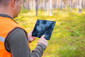
Setting Up an RTK Survey System
To establish a functional RTK survey system, you need to follow a series of steps carefully:
Base Station Setup
- Location Selection: Choose a location for the base station with a clear, unobstructed view of the sky. It should be a stable and known point.
- Antenna Installation: Mount a high-quality GPS antenna on the base station and ensure it is securely fastened.
- Receiver Setup: Set up the base station receiver and configure it to receive signals from GPS satellites.
- Data Logging: Configure the base station to log data and transmit it to the rover.
Rover Setup
- GPS Receiver and Antenna: Equip the rover with a GPS receiver and a high-gain antenna.
- Receiver Configuration: Configure the rover’s GPS receiver to receive correction data from the base station.
- Data Display: Ensure that the rover displays real-time position information with centimeter-level accuracy.
- Communication: Establish a reliable communication link between the base station and the rover for real-time data transmission.
Considerations for Successful RTK Survey
To ensure a successful RTK survey, you must take several factors into account:
- Clear Sky View: Obstructions like tall buildings, trees, or heavy foliage can interfere with satellite signal reception. Maintain an unobstructed view of the sky for accurate data.
- Base Station Location: The base station’s location should be stable and well-documented. Its coordinates must be known precisely to provide accurate corrections to the rover.
- Data Link Reliability: Establish and maintain a reliable communication link between the base station and the rover. Any interruptions in data transmission can lead to inaccuracies in the survey results.
Challenges and Limitations of the RTK Survey
RTK (Real-Time Kinematic) survey is a precise positioning technique widely used in various fields, such as land surveying, construction, agriculture, and geodesy. However, it comes with its set of challenges and limitations that need to be considered.
Signal Blockage
One of the primary challenges in RTK surveying is signal blockage. In urban environments with tall buildings, natural obstacles like trees, and other obstructions, the RTK receiver may struggle to maintain a clear line of sight to the satellites. This can result in signal interruptions, leading to inaccuracies in positioning data.
| Challenge | Description |
| Signal Blockage | Tall buildings, trees, and other obstructions can block satellite signals, causing inaccuracies. |
| Initial Cost | The equipment required for RTK surveying can be expensive, making it inaccessible for some users. |
| Technical Expertise | Skilled personnel are needed to operate and interpret data, which can be a limitation in some cases. |
Initial Cost
The initial cost associated with RTK surveying can be a limitation for many individuals and organizations. RTK survey equipment, including GNSS receivers and base stations, can be relatively expensive. This initial investment may deter smaller businesses or individuals from adopting RTK technology.
Technical Expertise
Another limitation is the need for technical expertise. RTK surveying requires skilled personnel who are well-versed in using the equipment, setting up base stations, and interpreting the collected data accurately. This expertise is not always readily available, which can be a barrier to adoption.
RTK Survey in the Future
Advancements in technology are continually shaping the future of RTK survey. Here are some key developments we can expect:
- Greater Accuracy: Advancements in satellite technology are expected to significantly enhance the accuracy of RTK surveying. Future satellite constellations, such as the Global Navigation Satellite System (GNSS) and improvements in correction services, will provide more reliable and precise positioning data.
- Wider Accessibility: As technology evolves, the cost of RTK survey equipment is likely to decrease, making it more accessible to a broader range of users. This affordability will open up new opportunities for small businesses and individuals to utilize RTK surveying in their operations.
- Integration with Other Technologies: RTK surveying is likely to become more integrated with other cutting-edge technologies. Drones equipped with RTK receivers can enhance aerial surveying capabilities, while autonomous vehicles can benefit from real-time positioning data for navigation and mapping. This integration will create new possibilities for diverse applications.
Conclusion
RTK survey represents a significant advancement in the field of precision navigation and surveying. Its high accuracy, efficiency, and versatility make it an invaluable tool in numerous industries. As technology advances, the scope and capabilities of RTK survey are only expected to expand, offering even greater precision and new applications.
FAQ
Q1: How accurate is RTK survey?
A1: RTK survey can achieve accuracies of a few centimeters, making it one of the most precise surveying methods available.
Q2: What is the difference between RTK and traditional GPS?
A2: Traditional GPS typically offers accuracies of about one meter, while RTK survey enhances this to a centimeter-level accuracy.
Q3: Can RTK survey be used in all weather conditions?
A3: While RTK survey can be used in most weather conditions, extreme conditions like heavy rain or dense cloud cover can impact accuracy.
Q4: How far can the rover be from the base station?
A4: The maximum effective range varies, but it’s typically around 10 to 20 kilometers.
Q5: Is RTK survey suitable for marine applications?
A5: Yes, RTK survey is increasingly used in marine applications like harbor construction and coastal management.


+ There are no comments
Add yours