

In the realm of civil engineering and road construction, conducting an intricate road survey proves to be a crucial component. This process entails meticulously scrutinizing and examining the designated area for constructing roads. The role of a proficient road surveyor is pivotal in ensuring seamless alignment between planned designs and geographic requirements during construction work.
For insights into optimizing your company’s online presence, including strategies for building effective backlinks, explore what kinds of backlinks ought companies prioritize in building?
What Does Road Surveying Entail?
Road surveying is a critical phase in the process of road construction and maintenance. It involves a comprehensive analysis of various aspects of the terrain, soil, alignment, and grading to ensure the safe and efficient construction of roads. Let’s explore the key components of road surveying:
Topographical Analysis
Topographical analysis is an essential component of road surveying. It involves the detailed examination and understanding of the landscape where the road will be constructed. This analysis includes the assessment of various geographical features such as hills, valleys, rivers, and other natural elements that can impact the road’s design and construction. The information gathered during topographical analysis is crucial for determining the most suitable route for the road, minimizing environmental disruption, and ensuring road safety.
The topographical analysis includes the following components:
| Component | Description |
| Terrain Evaluation | Identification of elevation changes, slopes, and natural features that may affect road design. |
| Hydrological Assessment | Examination of water bodies like rivers and streams to determine their impact on road construction. |
| Geological Investigations | Analysis of underlying rock formations and soil types to assess their stability and suitability. |
| Vegetation Study | Evaluation of existing vegetation and its potential impact on road construction and preservation. |
Soil Testing
Soil testing is a crucial step in road surveying, as it directly influences the road’s structural integrity and durability. Road surveyors conduct soil tests to evaluate the composition, density, and stability of the soil in the road construction area. The results of soil testing help engineers determine the appropriate construction techniques, materials, and road design that can withstand the soil conditions.
Various soil tests are conducted, including:
| Test Type | Purpose |
| Soil Composition Analysis | Identifying the types and proportions of different soil particles (e.g., clay, silt, sand). |
| Compaction Testing | Measuring soil density to ensure proper compaction during road construction. |
| Bearing Capacity Testing | Assessing the soil’s ability to support the weight of the road and traffic loads. |
| Permeability Testing | Evaluating how easily water can pass through the soil, which affects drainage design. |
Alignment and Grading
Alignment and grading are fundamental aspects of road surveying that determine the road’s geometric design and profile. The goal is to establish the precise alignment and grading of the road, ensuring optimal safety, comfort, and efficiency for users. Proper alignment and grading also contribute to reducing maintenance costs over the road’s lifespan.
Road surveyors take into account the following factors:
| Consideration | Description |
| Horizontal Alignment | Determining the road’s curve and straight sections for safe and efficient travel. |
| Vertical Alignment | Managing elevation changes, such as hills and dips, to maintain road safety. |
| Cross-Sectional Design | Designing the road’s cross-section profile, including lanes, shoulders, and slopes. |
Importance of Road Construction Surveying
Road construction surveying plays a pivotal role in ensuring the success and sustainability of road projects. Here are some key reasons why road surveying is of utmost importance:
- Safety: Safety is paramount in road construction, and surveying helps identify potential hazards and design roadways that minimize risks. By understanding the terrain and soil conditions, road surveyors can plan and construct roads that enhance driver safety.
- Economic Efficiency: Proper surveying leads to cost-effective road construction and long-term economic benefits. A well-designed road reduces maintenance expenses, prolongs its lifespan, and enhances its efficiency, ultimately saving taxpayer money.
- Environmental Protection: Minimizing the environmental impact of road construction and maintenance is essential. Through careful analysis and planning, road surveyors can implement strategies to protect natural resources, wildlife habitats, and minimize soil erosion, contributing to sustainable infrastructure development.
The Road Surveyor: A Closer Look
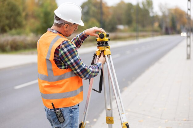
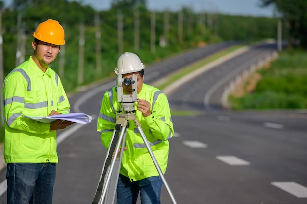
A road surveyor is a trained professional who is responsible for the precise measurement and evaluation of the land. They use specialized equipment like GPS, total stations, and laser levels to capture accurate data.
Roles of a Road Surveyor
Road surveyors are entrusted with several critical responsibilities, all of which contribute to the successful execution of road construction projects. These roles include:
- Data Collection: Data collection is the foundation of a road surveyor’s work. They use advanced instruments to gather precise information about the land. This data includes topographical features, existing structures, natural obstacles, and soil composition. The key tools for data collection include total stations, GPS systems, and laser levels.
- Analysis and Planning: Once the data is collected, road surveyors meticulously analyze it to make informed decisions about road construction. They interpret the gathered information to create detailed plans and blueprints. This involves determining optimal road alignments, slopes, and elevations. Effective planning is essential to ensure the road’s safety, durability, and compliance with regulatory standards.
- Ongoing Monitoring: Road surveyors don’t stop after the initial planning phase. They play a vital role in monitoring construction progress to ensure that it adheres to the planned guidelines and specifications. Ongoing monitoring involves regular site visits, quality control checks, and adjustments to the construction plan as needed. This continuous oversight helps maintain project integrity and minimizes the risk of errors.
The Tools of the Trade
The work of a road surveyor relies heavily on a set of specialized tools and equipment designed for accuracy and precision. Here are some of the essential tools used by road surveyors:
- Total Station: Total Station is a multifunctional surveying instrument that combines electronic theodolite and distance measuring equipment. It is used to measure angles and distances with exceptional precision. Total stations are capable of both horizontal and vertical angle measurements, making them indispensable for creating accurate topographic maps and collecting detailed land data.
- GPS Systems: GPS (Global Positioning System) technology is integral to modern surveying. Road surveyors use GPS receivers to determine precise locations on the Earth’s surface. These systems rely on signals from satellites to calculate positions, making them essential for accurate mapping, georeferencing, and tracking of construction sites. GPS systems provide real-time data that is invaluable for road construction planning and monitoring.
- Laser Levels: Laser levels are indispensable tools for ensuring level and even road surfaces. These devices project a highly visible laser beam onto a surface, allowing surveyors to establish reference points and measure elevations accurately. Laser levels are essential for achieving the desired road gradient, eliminating irregularities, and ensuring road safety.
Road Construction Surveying: The Process
The process of road construction surveying typically involves several key steps:
Preliminary Survey
The preliminary survey marks the starting point of road construction surveying. During this phase, surveyors conduct an initial assessment of the project area. Key objectives include:
- Identifying the project’s boundaries.
- Evaluating the existing road network, if applicable.
- Assessing the general terrain and geographical features.
- Gathering initial data to estimate project costs and timelines.
The preliminary survey provides essential information for project feasibility studies and early decision-making.
Detailed Survey
The detailed survey is a meticulous data collection phase that follows the preliminary survey. It involves gathering comprehensive information about the terrain, existing infrastructure, and other critical aspects. This phase includes:
- Topographic surveys to capture precise elevation data.
- Examination of soil composition and stability assessments.
- Identification of potential obstacles or environmental concerns.
- Establishing accurate horizontal and vertical alignments.
The data collected during the detailed survey is instrumental in the subsequent design phase.
Design Phase
Based on the data collected during the detailed survey, the design phase is where road construction plans are formulated. This phase encompasses:
- Creation of detailed engineering drawings and blueprints.
- Determination of road alignment, cross-sections, and gradients.
- Selection of materials and construction techniques.
- Compliance with regulatory standards and environmental considerations.
The design phase serves as the blueprint for the construction process, guiding engineers and construction crews.
Construction Phase
The construction phase is where the plans and designs are translated into physical infrastructure. This phase involves continuous monitoring and adjustments to ensure adherence to the specifications. Key activities include:
- Earthwork and excavation.
- Installation of drainage systems.
- Pavement construction and surfacing.
- Quality control checks and inspections.
- Environmental mitigation measures.
During this phase, road surveyors play a crucial role in overseeing the project’s progress and addressing any unforeseen challenges.
Key Challenges in Road Surveying
Road surveyors encounter several challenges during the surveying process. Addressing these challenges is essential for the accuracy and success of road construction projects. Some of the key challenges include:
- Terrain Difficulties: Terrain difficulties often arise in projects involving rugged or unstable landscapes. Surveyors must navigate steep slopes, rocky terrain, and uneven ground, making data collection more complex and time-consuming. Specialized equipment and techniques are required to overcome these challenges.
- Weather Conditions: Extreme weather conditions such as heavy rainfall, snow, or extreme heat can impact both data accuracy and equipment functionality. Adverse weather can hinder fieldwork, leading to delays in data collection and potential safety hazards for surveyors.
- Urban Areas: Surveying in densely populated urban areas presents unique challenges. Road surveyors must plan meticulously to minimize disruption to traffic flow and daily life while conducting surveys and construction activities. Coordination with local authorities and residents is essential to ensure a smooth process.
Innovations in Road Surveying
Advancements in technology have significantly improved the efficiency and accuracy of road surveying. These include:
Drones in Road Surveying
Drones, also known as Unmanned Aerial Vehicles (UAVs), have emerged as a game-changer in road surveying, offering several advantages, particularly in accessing large or remote areas that were previously challenging to survey. Key features and benefits of using drones in road surveying include:
| Feature | Description |
| Aerial Surveys | Drones capture high-resolution aerial imagery, enabling comprehensive site analysis. |
| Rapid Data Collection | Quick data collection allows for faster project planning and decision-making. |
| Cost-Efficiency | Reduced costs compared to traditional surveying methods, including manned aerial surveys. |
| Accessibility to Inaccessible Areas | Drones can access rugged terrain, forests, and other difficult-to-reach locations. |
3D Laser Scanning in Road Surveying
3D laser scanning technology has revolutionized the way road surveyors collect and analyze data. It offers precise, three-dimensional models of the terrain, resulting in enhanced project planning and execution. Key features and benefits of 3D laser scanning include:
| Feature | Description |
| High Precision | Accurate data collection with laser beams, reducing errors in terrain modeling. |
| Detailed 3D Models | Provides detailed 3D representations of the surveyed area, aiding in design and analysis. |
| Time Efficiency | Rapid data capture, minimizing survey time and reducing fieldwork costs. |
| Improved Safety | Minimizes the need for surveyors to work in hazardous conditions, improving safety. |
GIS Technology in Road Surveying
Geographic Information Systems (GIS) technology plays a pivotal role in road surveying by providing advanced mapping and data analysis capabilities. Here are some key features and benefits of GIS technology in road surveying:
| Feature | Description |
| Spatial Data Analysis | GIS enables in-depth spatial analysis, allowing for better decision-making in road planning. |
| Data Integration | It integrates diverse data sources, such as land use, environmental factors, and traffic data. |
| Visualization | GIS tools provide clear and insightful visualizations, aiding in data interpretation. |
| Real-time Data | Access to real-time data enhances situational awareness for road management and maintenance. |
Conclusion
Road surveying, led by skilled road surveyors, is a fundamental aspect of road construction. It not only ensures the structural integrity and safety of roads but also plays a crucial role in environmental conservation and economic efficiency. The continual evolution of technology in this field promises even greater precision and efficiency in the future, paving the way for better, safer, and more sustainable roadways.
FAQ
Q1: How long does a road survey take?
The duration depends on the project’s size and complexity. Smaller projects may take a few days, while larger ones can take several weeks or months.
Q2: Is road construction surveying necessary for all road projects?
Yes, it’s crucial for all road construction projects to ensure safety, efficiency, and compliance with regulatory standards.
Q3: Can road surveyors work in any weather condition?
While road surveyors are equipped to work in various conditions, extreme weather can sometimes cause delays or require rescheduling.
Q4: How has technology changed road surveying?
Technological advancements like GPS, drones, and laser scanning have made road surveying more accurate, faster, and more efficient.
Q5: Are there environmental considerations in road surveying?
Absolutely. Road surveyors consider environmental factors to minimize the ecological impact of road construction.


