
Have you ever felt overwhelmed by the complex lines and symbols on a topographic map? Don’t worry! This article aims to simplify the world of simple topographic maps, making it accessible for everyone. Whether you’re new or experienced, having knowledge about contour lines in these maps can lead to exciting adventures and broaden your understanding of geography.
What is a Simple Topographic Map?
Let’s start by defining what a simple topographic map is, before we get into the specifics of contour lines. Essentially, this type of map offers detailed and quantitative representations of relief on a large scale. Unlike traditional maps that only show two-dimensional perspectives, it incorporates contour lines to provide three-dimensional views. Let us take a closer look at some key characteristics that make up the basic framework behind every simple topographic map design!
Large-Scale Detail
Topographic maps with a straightforward design are recognized by their meticulous representation, allowing for an up-close examination of a limited portion of the planet’s surface. This comprehensive depiction plays a significant role in pursuits such as trekking, where accurate familiarity with the land is imperative to ensure security and direction.
Quantitative Representation of Relief
The use of contour lines, which are the distinguishing characteristic on topographic maps, quantitatively illustrates relief or elevation changes in a landscape as one of their fundamental functions.
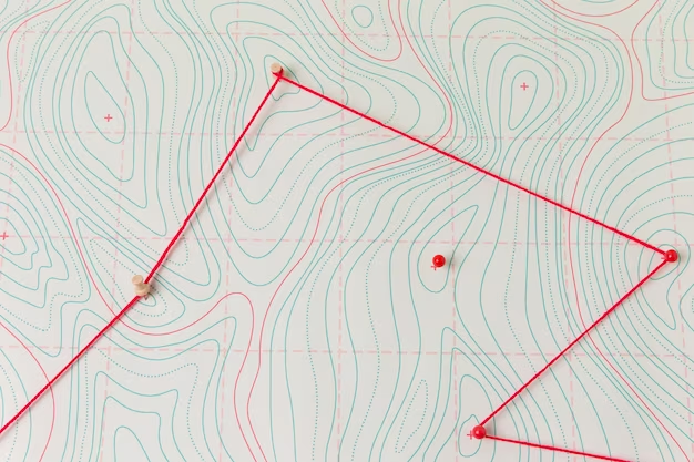
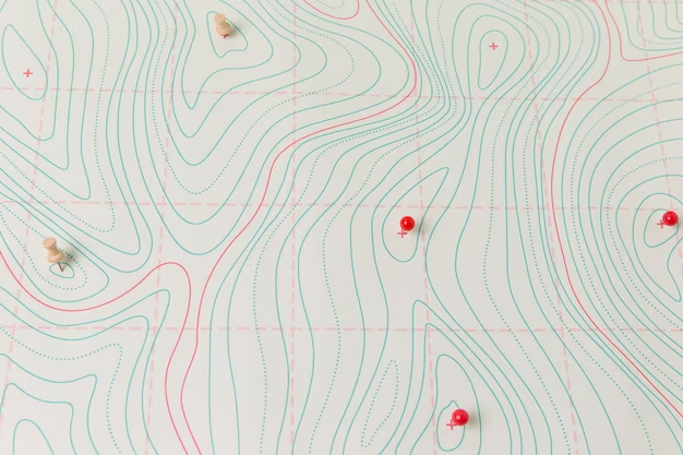
Contour Lines
The fundamental component of a basic topographic map is the contour lines. They act as a graphical depiction indicating the height and composition of the land, providing important details about its topology such as inclines or depressions. By deciphering contour lines, one can learn invaluable information concerning geographical features like hillsides and valleys. Here’s how these significant reference points operate:
- Equal Elevation: Contour lines on a topographic map represent areas of the same elevation. Essentially, following one contour line means that your altitude will remain unchanged throughout its course. This feature enables you to visualize changes in terrain elevations more effectively.
- Vertical Interval: The vertical interval, also referred to as the contour interval, determines the distance between successive contour lines and is a reflection of the steepness of a given slope. The closer these lines are together, the steeper terrain they signify; while those that appear farther apart indicate more gradual slopes. For instance, an elevation change by 10 feet is represented by each distinct contour line if set at an interval rate of 10 feet.
- Index Contours: In order to make reading elevations easier, index contours are used where every fifth contour line is drawn thicker and labeled with elevation values. This allows for quicker identification of specific points on the map with their associated elevations.
Uses of Simple Topographic Maps

Simple topographic maps find applications in various fields, and their utility cannot be overstated:
- Hiking and Outdoor Activities: Engaging in hiking and other outdoor activities necessitates the use of topographical maps. These maps aid hikers in determining optimal routes, evaluating terrain ruggedness, and safely traversing difficult landscapes.
- Geographical Studies: Geographical research involves the examination of topographic maps by geographers to examine terrain formations, investigate watersheds and comprehend surface characteristics of our planet.
- Urban and Regional Planning: The maps serve as tools for urban and regional planning purposes, allowing planners to evaluate land appropriateness for development, pinpoint potential flood-prone areas and strategize infrastructure undertakings.
- Environmental Science: Topographic maps are used by environmental scientists to evaluate the influence of land use on the natural environment. Through this, they can analyze erosion patterns and water flow as well.
- Emergency Management: Topographic maps are essential for emergency management teams during natural calamities like wildfires or floods as they facilitate a comprehensive comprehension of the terrain that plays an integral role in ensuring efficient rescue and response operations.
How to Read a Simple Topographic Map
Reading a simple topographic map is a valuable skill, especially for outdoor enthusiasts, geographers, and anyone who needs to understand the terrain’s elevation and shape. Here’s a step-by-step guide on how to effectively read a topographic map:
Identify the Scale
To establish the correlation between distances on a map and physical measurements, the scale holds significant importance. The proportion of spatial representation aids in comprehending how much territory on the map corresponds to specific real-world dimensions. In most cases, this ratio is indicated as 1:24,000 or 1 inch = 1 mile precision marks meaning that each inch measurement exhibits one mile coverage demarcation in actuality. It goes without saying that interpreting scales accurately plays an integral part when it comes to measuring distance appropriately and mapping out optimal routes accordingly.
Understand the Legend
The map’s legend is integral in deciphering the variety of symbols, colors, and markings presented on it. Frequently located at a corner of the map, it imparts crucial details on what each distinct feature signifies – ranging from rivers to buildings to vegetation. Thus before exploring the comprehensive picture portrayed by the map itself, take care to acquaint oneself with its accompanying key.
Read the Contour Lines
Contour lines are the heart of a topographic map, offering valuable insights into the terrain’s elevation and shape. To effectively read contour lines:
- Equal Elevation: Contour lines represent equal elevation: they connect points on a map that share the same height above sea level. If you trace one contour line, it will maintain its altitude along your entire route. These lines never cross or intersect each other in any way.
- Vertical Interval: The vertical interval on a map refers to the distance between contour lines, and it can be used to determine the degree of steepness in an area. If more closely spaced contour lines are present, this indicates a steeper slope; whereas less frequently occurring contours indicate gentler terrain. The legend on a map usually specifies the exact measurement for determining vertical intervals.
- Index Contours: The bolder index contours, typically every fifth contour line and engraved with elevation values, facilitate swift recognition of altitude shifts and vital geographical features on the map.
Determine Direction
To ensure accurate reading and proper alignment with the surroundings, it is recommended to utilize the consistent north-oriented placement of topographic maps at their top.
Using Simple Topographic Maps for Navigation
After acquiring the fundamental knowledge of reading a simple topographic map, you can utilize this expertise to navigate and plan more efficiently. Here are some useful suggestions:
Route Planning
Make sure to utilize your topographic map for planning the route before starting any outdoor excursion. Take note of:
- Elevation Changes: The contour lines will give you a comprehensive idea of the variations in elevation on your preferred path, which assists you in preparing for challenging inclines or declines.
- Potential Obstacles: Recognize any bodies of water, steep precipices, or thick foliage that could impede your progress.
Identifying Landmarks
To avoid getting lost, it is useful to rely on topographic maps since they allow you to identify landmarks that can serve as points of reference for navigation. It’s worth noting conspicuous features such as mountain tops, lakes and noticeable bends in rivers when exploring your surroundings – confirming your location with respect to these notable sites may come in handy!
Assessing Difficulty
The spacing of contour lines is an excellent indicator of terrain difficulty. Steep slopes are represented by closely spaced lines, while gentle slopes have lines spaced further apart. This information can guide your route selection, especially if you’re looking for a more leisurely hike or a challenging ascent.
Conclusion
Simple topographic maps are a gateway to understanding and exploring the physical world around us. By mastering the basics of contour lines and map reading, you equip yourself with a powerful tool for navigation and appreciation of the natural landscape. Whether you’re planning an expedition or just curious about the world’s topography, these maps offer a clear and detailed view of the terrain. Embrace the adventure and let simple topographic maps guide your way!
FAQ
Q: How accurate are simple topographic maps?
A: They are generally very accurate, but remember, landscapes can change over time, so always check for the most recent map.
Q: Can I use a simple topographic map for urban planning?
A: Absolutely! These maps are crucial for understanding the terrain for construction, zoning, and urban development.
Q: Are simple topographic maps useful for all types of outdoor activities?
A: Yes, they are great for hiking, biking, camping, and any outdoor activities where navigation is key.
Q: How often are these maps updated?
A: This varies. Some are updated regularly, while others might be older. Always check the publication date.
Q: Do I need special training to read these maps?
A: No special training is required, but practice and familiarity with the map’s symbols and scales are beneficial.


